South Downs Way Day 8 - Bo Peep Farm to Eastbourne
- Jane Smith
- Apr 10, 2024
- 8 min read
The day started with another of those moments of interaction that I love about doing these walks. I had a long chat with Eileen and John, who run the excellent Bo Peep Farmhouse B and B. We particularly discussed asphasia and the difficulties of similar problems and shared techniques of managing it. Later, John very kindly gave me a lift back up to where I’d finished yesterday, and on the way he was telling me that the road up to the Downs had been built by the Canadians who had been stationed here in WW2. The area had been used for training. People still find bombs and other armaments when out walking. John told me that the bomb disposal experts can have problems finding these again, as when people pick them up and realise what they are they throw them away as hard as they can. Understandably, I’d suggest. He was also telling me of the origins of the farmhouse name, which is shared by the car park. He said that the nursery rhyme about Bo Peep can be read as a reference to the revenue men who chased the smugglers, and their house had been used as a centre for the forces of law and order back in the day.

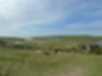
After yesterday’s weather madness, it was a huge relief to have a totally different feel up on Bostal Hill today. There was a faint breeze, the sun was shining and the larks sounded incoherent with delight. There was a spectacular wide vista across the plain, but no paragliders. My guide book told me that it’s a popular place for them, but I had to imagine them instead. On the other side of me I could see a ferry, presumably heading for Newhaven.


It was a lovely couple of miles, chatting to my mum as I descended to Alfriston, encountering a herd of ponies who seemed to think I’d have snacks. I gave them short shrift, nobody gets my snacks. I chatted to a fox who was out and about, and walked into Alfriston centre on the look out for coffee.


And I was rewarded by the The Singing Kettle, with a comfy seat out in the sunshine. And to make it better I was joined first by Richard, a singer who was grabbing a quick coffee before going to practise for Evensong at Chichester cathedral, and then Simon, who had flown over from Australia to look at properties in Alfriston. We drank the coffee that Richard said, with some justification, was the best in Sussex, and talked. A meaningful conversation about the nature of friendship, our roles as parents, the relationships with our children, the gendered way that those relationships work. And then we all went our separate ways, and I bought a massive date flapjack for later!


Alfriston is on the edge of the Cuckmere river, and at this point the South Downs Way splits. The cyclists and riders go inland, the walkers go towards the coast. The path meanders along the water in scenes of extraordinary loveliness. I can see why Simon’s partner was keen to live here. The air was filled with birdsong, and the lovely flat green track was springy and forgiving.


As it reached Litlington things were not quite as easy underfoot, with a huge flood that necessitated a bit of a detour. But that’s nothing to the other floods in Sussex today, which I understand have reached the news. Fortunately not where I am. That’s the floods, not the news.

As I arrived in the village, that was the end of the flat walking for the day. The rest of the SDW to Eastbourne is all about the incline. The first hill rewarded me with a view over to a chalk white horse to the west.

The next, after Charleston Manor used steps, which was a nice change from a steep grass path, but as always they were positioned just a bit too far apart and just a bit too high for my stumpy legs.

The steps led into a little copse. Compared to the wintry woods of a few days ago it felt like we’ve properly gone into Spring. There were green shoots on the ground, unfurling leaves, bird song and children making dens.
At Westdean I had a little break with my excellent flapjack. And then more steps. My guidebook exclaims rather over excitedly ‘nearly 100 of them!’.

But they were worth it, as out of the next little copse the view over Cuckmere Haven springs into view. What a sight, with the sky, the snaking river and the sea. It was a harbinger of the joy awaiting me on the rest of the walk today.
I popped into the Seven Sisters Country Park information centre to find out what the names of the Seven Sisters are, as I had been challenged by my friend Justine to report them back to her. I was surprised when the young man in charge of the information centre didn’t have that information. However, further research tells me that they are Haven Brow, Short Brow, Rough Brow, Flagstaff Brow, Flat Hill, Bailey’s Hill and Michel Dean. The names refer to the high sections of the undulating coast line approaching Beachy Head.

I had been told that there was the possibility of taking a small shortcut to avoid Exceat Hill. But I wasn’t in the mood for a shortcut. And I was later glad of it, as otherwise I wouldn’t have witnessed a sheepdog manoeuvring a large herd of sheep into an unfeasibly small pen.

As I approached the watery area in the way to the Sisters I could see that there were a lot of teenagers about. There was a lot of good humoured laughing and running around, and large groups negotiating the initial climbs. As I passed a couple of young men, they called out a greeting and I stopped to chat. Tiemen and Jelle were part of a large contingent of teenagers from the Netherlands, over in the UK for 5 days. They were charming, interesting and enjoying their surroundings. And speaking excellent English, in the same way as every Dutch person I’ve ever met.

Later I met a number of the rest of the group. One large contingent were asking about the blog, and how many readers I get a night. When I said it was a few hundred, they gasped and declared I was a celebrity. Which was very sweet and hilarious. And they all wanted to be in the photo. I told their teachers with absolute honesty that they were all a delight.

Walking the Seven Susters is like being on an extremely slow and utterly beautiful rollercoaster. There are a lot of ups and downs. The guidebook, less excitable this time, describes it as an ‘energetic stretch’ that will ‘test your level of fitness’. I really enjoyed it. It’s nothing like as difficult or steep as the South West coastal path, and no section, whether up or down, would go on too long. The views were wonderful, with the blue sky and the white of the cliffs. And it gratifyingly made me realise that I’m pretty fit.


There was more talk of smugglers half way along, at Brass Point where there had been a coastguard station. Later at Flagstaff Point I paused to watch the seabirds whirling around the cliff, presumably where they were going to be nesting.

Erosion is a constant feature of this coastline, and there are many warning signs about the danger of being too close to the edge. So I kept myself at a sensible distance to have my final rest with my thermos. The grass was soft and the tea was hot. So lucky to be there, and so glad that I’d decided to do this.

Towards the end of the rollercoaster, I saw another model aircraft. As I approached I could see it was the same three men that I’d seen yesterday on Itford Hill. One was flying with great concentration, but the other two, Martin and Moritz explained about their gliders, and how they have no motor. They harness the wind with the use of the flaps on the wings in the same way as a full size glider would, just using remote control instead. They are from Switzerland, and come over to the UK for a week at a time to fly.


Finally the Seven Sisters were complete, and I was rewarded with the National Trust cafe at Birling Gap. I sat next to an Australian family that I’d passed on the way. The two lovely youngsters were happily chatting about how it was the longest walk they’d done, and that their feet hurt. They asked what I was doing, and when I said that I was doing over 100 miles in 8 days, the elder one looked at me rather baffled and said ‘do you do this for fun?’
After Birling Gap the rollercoaster turned into more of a theme park vibe. There is a car park by the cafe, and a lot of people had been disgorged there. So there was suddenly a lot of selfies and crowds of people. I think it’s great that lots want to come to enjoy this amazing place, but I wanted a bit more of my own space before this adventure finished. So I accelerated away towards the old lighthouse that is now a luxury B and B, and then up to Beachy Head, with the apparently tiny lighthouse below it, dwarfed by the massive cliff.


And there, David and Saffy (our dog) were waiting. It was so great to see them.

But the South Downs Way doesn’t finish at Beachy Head. So after a little while David drove on to the official finish, whilst I went down the path by foot. Just below the cliff there was an extremely touching memorial to the thousands of men from the RAF Bomber Command who were killed in action. The text said that ‘for many, Beachy Head would have been their last sight of England’.

There was a very steep path down off the Head on the way to Eastbourne, which was the hardest descent of the whole 8 days. This led to a grassy path along the shore with Eastbourne and its pier ahead.


And then eventually, past a sports field on which a man was solitarily perfecting his golf swing, to the path that led to the end. As often with these trails the ending is a bit of an anticlimax, a wooden sign next to a closed cafe and a little car park. So once we’d taken the requisite proof of life pictures, I decided to stop in a more meaningful place.


I walked another couple of miles along the quiet coastal path, admiring the acrobatics of windsurfers, aiming for the faded glory that is Eastbourne Pier. I listened to some of my best songs, as a quiet and personal triumphal procession. And I ended my walk the way I wanted to do it.


Since Winchester I had carried with me a lucky charm which had given me comfort on all my previous big walks. I had attached much meaning to it, it was full of connotations, and I had felt that it gave me courage. When I got to the sea I thought that it would be a symbolic gesture to throw it in the water as a sign of new beginnings and starting to live my life differently. But I found that I didn’t have it in my pack after all. It must have fallen out en route. So the courage had come from inside me, and the new beginnings had already begun.

Postscript
This morning I had woken early and read a bit of the paper on my phone. An article in The Guardian by James Gingell about walking Corsica’s GR20 (that I won’t be doing!) felt like another of those symbolic messages that have sprung out at me over the last eight days.
That happiness is not about new stuff, better clothes, a bigger house; nature and connection are worth far more. That we’re strong and we can do impossible things. Like walking up mountains. Or just being happy. And we pack all that knowledge in our bags and take it down the mountain.
Thank you for walking alongside me by reading this blog. It’s meant such a lot to know that people have been enjoying it, and commenting too. I’ll probably not do another big walk for a while, as David and I have some exciting adventures together coming up this summer. But maybe there’ll be something in the early autumn. If you want to be the first to know if I’m off again then do subscribe if you’d like. In the meantime, let’s all go off and do impossible things like walking up a mountain or just being happy.
J x
Stats
Distance travelled - 15.6 miles
Total ascent - 2336 feet
Calories burned - 2372
Video of the walk